Biking to Oregon: Day 6 - North Dakota Needs a Welcome Sign
My hotel was slightly off course from the Northern Tier route, and I had plans today to divert from the route until North Dakota. The Northern Tier route kept going northwest from Fergus Falls to Fargo, North Dakota, and then back down south. I opted to skip Fargo and go northwest for a shorter distance before diverting directly west.
Google Maps helped route me to State Highway 46 in North Dakota where I would rejoin the main route. I stopped at an Einstein Bros Bagels in North Dakota and went through the drive-through to get an egg sandwich for breakfast, and then ate it outside, alone. Nobody else was eating outside on a Thursday morning with approaching rain.
After breakfast, I stopped at a Walmart to supplement my butt care package that I should’ve spent more time addressing at the Walgreens the day before. I bought rubbing alcohol wipes and vaseline, and then applied both in the Walmart restroom. This was a new experience for sure, but one that would hopefully help make biking more enjoyable going forward. I went back outside to encounter the start of a brief rain shower. I moved my bike under some shelter and put on my rain jacket and waited for the rain to pass. It eventually died down, so I started Google Maps, put in my right earphone and was on my way.
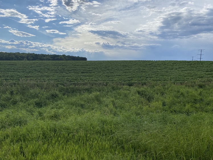
Google Maps took me on a gravel road to continue northwest. I usually like gravel since it means fewer cars. The gravel eventually turned to pavement, and I had a nice tailwind pushing me northwest.
I stopped by an antique store in Wolverton, the last town in Minnesota before entering North Dakota. The store promised ice cream and cold drinks on a sign out front. An older couple running the store greeted me inside.
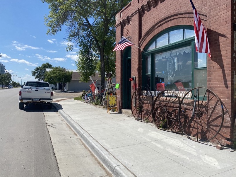
The store was cluttered, but had an old fridge that I opened to get a soda, water, and an ice cream sandwich. I paid with cash and ate the ice cream sandwich outside the store. It wasn’t even the afternoon, but that doesn’t mean it was too early for ice cream. My goal was to eat what sounded good, and ice cream usually sounds good.
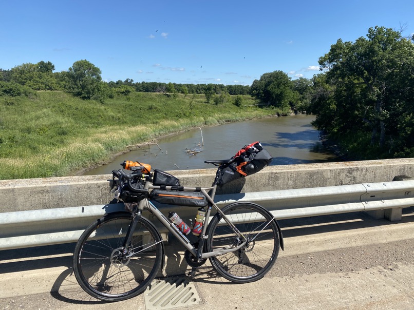
Shortly afterwards, I crossed the Red River to enter North Dakota. There was no sign welcoming me, but since I had Google Maps voice navigation, it made sure to welcome me to my third state of the trip.
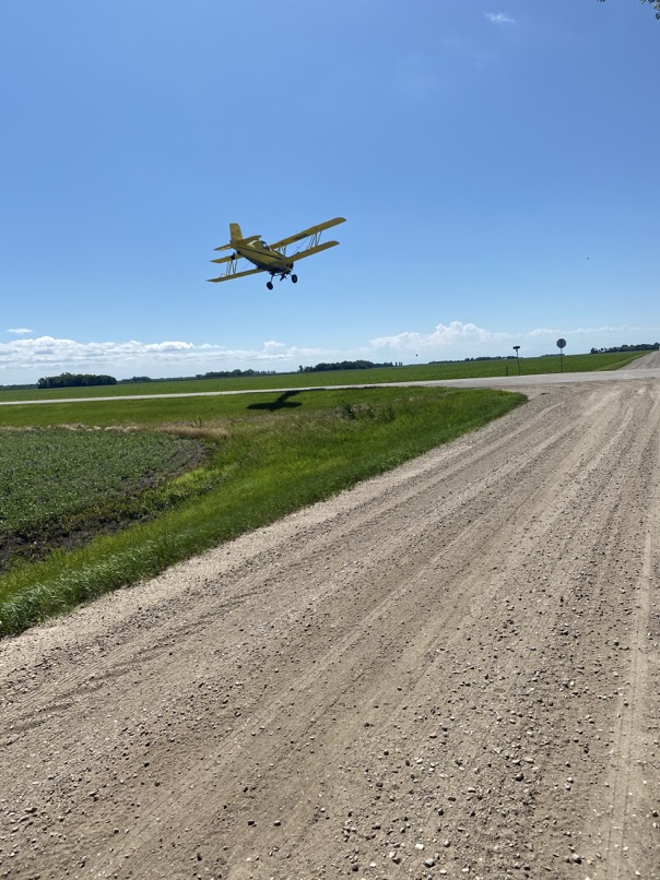
After continuing west for several miles, Google Maps prompted me to turn right to go north on a gravel road. I figured if it was anything like the previous gravel road, then it would be worthwhile. The gravel became loose and consisted of a lot of sand, causing my wheels to dig in. I noticed the giant rut I was leaving and decided to turn around and force Google Maps to reroute.

All this time a crop duster was flying close to me which added some entertainment to the otherwise wasted miles.
I eventually joined back up with the Northern Tier route on Highway 46 going dew west. The towns were starting to get farther apart. The wind had also shifted to now blowing out of the west. One thing I noticed about North Dakota in particular is that a lot of the towns are off the main highway. In the afternoon this day, I had to make a choice between adding additional miles to stop and refill food and water, or continue on without the extra detour. I chose the former, opting to stop at a gas station for snacks, water, gatorade, and a soft serve ice cream cone. Gatorade and Powerade was starting to become a normal occurrence. It was hard to eat enough solid food constantly, but supplementing liquid calories made it easier to sustain enough energy throughout the day.
At this point, I was feeling pretty beat up. The wind was not in my favor. The road was busy and had a small shoulder. My butt wasn’t getting any better. Some of my fingers were starting to lose sensation. I was lonely. I stopped in the restroom in the gas station to reapply my Walmart care package. Afterwards, I gave Abbey a call for some emotional support.
I got back on the main highway and continued west, aiming for the town of Enderlin. ACA listed a city park as a campground, and I called the phone number to confirm it was open. The person who picked up the phone seemed to work for a local government agency and said I was welcome to camp, no payment needed.
I arrived and set up camp next to a picnic shelter. There was a public restroom close by, not unlike Bowlus, Minnesota. I took a sink shower and then tried charging my USB battery backup in the bathroom outlets. It still wouldn’t charge. At this point, I called the manufacturer to see if they could mail me a new unit at one of the towns I would pass through. They said they needed the old unit back before they could mail the new one. I figured even if I mailed the unit back tomorrow, it would be unlikely I would receive a new unit anytime soon, and it would be difficult to figure out which town the new unit should be shipped to.
From that point, I decided to continue my journey with the unchargeable battery backup. It was still able to charge my devices, but the unit itself wasn’t able to be charged. It had 60% battery left, and I made a deal with myself that I would only use it if I needed to. Otherwise, I would rely on restaurants, gas stations, and hotels to charge my batteries.
I searched through the few restaurant option in the town of 833 people. I called a restaurant which said they delivered, and I said I was at the city park down by the river. To my surprise, the server was confused where I was located, and I had to double check that I was calling a restaurant that was in the same town as I was. He eventually understood my location, and I saw someone pull up and walk towards me with my order a half-hour later. A chicken sandwich and fries. Meat on a bun with fried potatoes would become a usual meal at this point, mostly because it was the only option.
I called Abbey as I did most nights, but I was needing more emotional support at this point. My sore butt and the recently noticeable numb fingers was becoming frustrating. I felt as though I was starting to get my butt under control, only to have a new issue pop up. Abbey encouraged me to get some ice cream and call my parents. After we talked, I biked to a gas station to get ice cream and a soda, and then took them back to the park and called my parents. Some sugar and human contact really helped out that night.
As I went to bed, I started to watch the movie “Inspired to Ride”, which documented the 2014 TransAmerica Bike Race. The race follows the ACA TransAmerica route from Astoria, Oregon to Yorktown, Virginia. I was amazed at how far the racers were riding each day, with the winner, Mike Hall, finishing in under 18 days. It was good to watch people suffer more than I was suffering. One rider was talking about how he was starting to notice blood drip down his leg from his saddle sores, and another rider described how one of his entire hands went numb and stopped working. My butt wasn’t that bad. My hands weren’t that bad either. I went to sleep knowing that while I wasn’t in an optimal condition, things could be much worse, and I can take steps to make them better.