Willamt Nonstop Summary and Gear
I just finished biking Willamt Nonstop, a 400+ mile mixed terrain race around Oregon's Willamette Valley, and I wanted to share my thoughts while they're still fresh in my mind. I also wanted to share the gear that I used for this event.
Cool Morning Start
A group of 7 of us met at Verdell Burdine Rutherford Park on the east side of Portland for a 6 AM start. It was about 37°F with temperatures expected to increase into the weekend.
We all headed as a group to the Springwater Corridor Trail, a paved path that takes us to Boring (yes, that is the name of an Oregon town). Everyone started to find their own pace towards the end of the trail section.
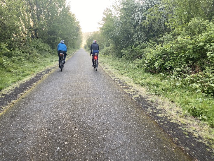
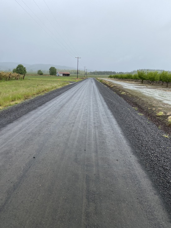
This route has over 25,000 feet of climbing and I knew most of the climbing was going to be on the first half of the route. I caught up to another rider, Tom, and we rode together for a couple hours, sometimes having gaps form and then getting back together. Since it was a weekday, there was a little bit of traffic on the backroads outside of Portland, but not too bad and only improved as we got farther away from the city.
Around 35 miles in, Tom and I came upon Hult Road near Colton, a gated road permanently closed due to landslides. Most of it was still rideable with just a short hike section. It was a fun descent down a road lost to mother nature and gravity.
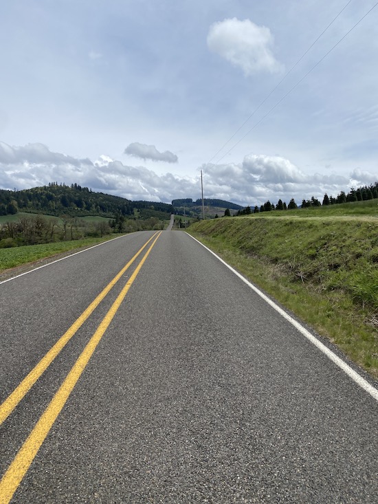
The roads around this area were so beautiful. I think these hilly unpainted narrow paved forest roads are my new favorite kind of roads.
I got ahead of Tom on a climb and then stopped at a market in Scotts Mills to refill on food and water around 60 miles in. The tracker app developed by the ride director, Nathan, was a great way to share photos and videos along the route in addition to tracking everyone's location. The app showed that Tom passed me while I was resupplying.
I also plugged in my phone and GPS to a battery so they could stay charged while riding. Rain was expected later in the day and into the next morning, so I wanted to take advantage of the dry weather to charge electronics while I could.
I caught back up to Tom on a climb outside of Scotts Mills and we rode together a little more before I pulled ahead up the final part of the climb and down a gravel descent. This ended up being the last time I saw Tom on the ride, but he was still close behind me and it seemed like he was really good at riding long distances without stopping.
In addition to the hilly forest roads, another highlight of the route was riding through Silver Falls, especially on a weekday morning since there was little traffic. It's a very curvy road through the forest with some nice gradual climbs and descents.
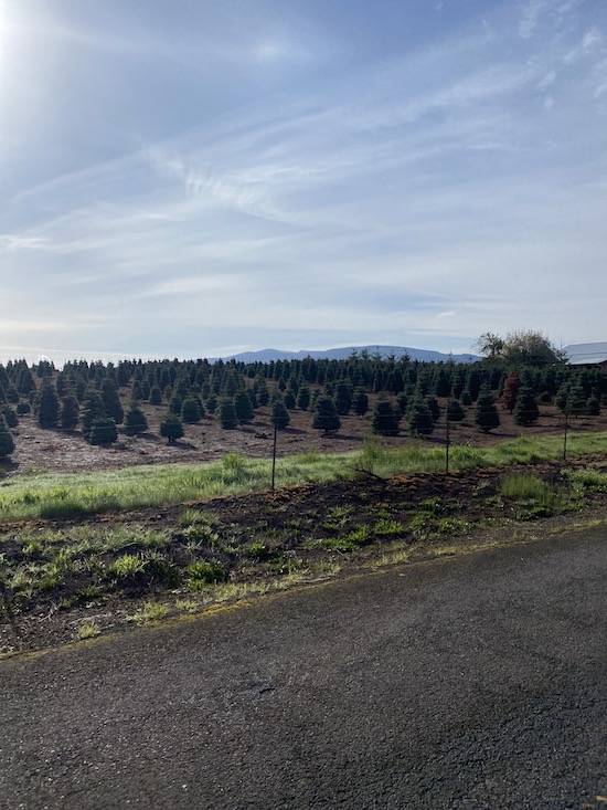
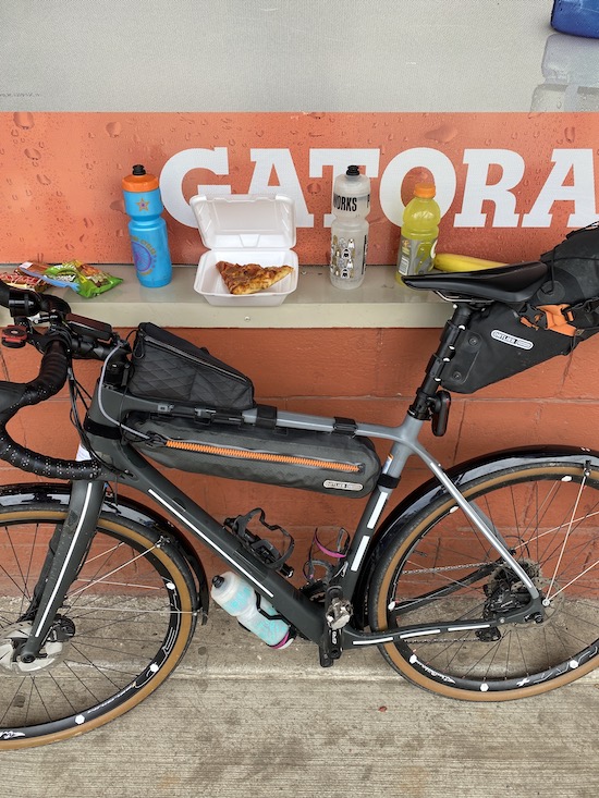
Out of Silver Falls, the route transitioned from the forest to farm country, but the roads were still plenty hilly. I stopped at another local market at 100 miles in Lyons. These local market owners are so friendly. I asked for a slice of the pizza they had on display, and they said it was a little dry and it's on the house. It tasted great, and likely even better knowing it was free food. I also got a corn dog for the road along with my usual assortment of candy bars and fruit. With the built-in handle and long shape, corn dogs make great food to store in a pocket and eat later while biking.
The next section of the route took us out of hill country and into wooden covered bridge country with much flatter roads. At one point, the route had us turn off a highway and through the gravel ditch on the side of the road to connect to the end of a dead end road. The maps incorrectly think these roads connected. The actual turnoff was only 100 feet up the road, but hey, the route is the route, so through the gravel ditch I went.
I came upon a covered bridge that was closed due to construction. I waited near it while looking at possible detours on the map, hoping a worker would see me and let me through. No one seemed to notice me, so I added another climb to detour around the bridge.
Rain and Into The Night
Light rain started while I was making my way through covered bridge country and started to get more intense as I got to Waterloo. I put my phone in a ziplock bag to keep the charging port from getting wet, since that can take a long time to dry out, and it never would unless I was inside.
Back into the woods out of Waterloo, the route had us climb another big hill and descend into Brownsville. I was completely soaked from head to toe at this point, but I was still warm unless I stopped biking for more than 5 minutes.
I was happy to make it to Brownsville before sunset, since it was the last town before the biggest climb and most remote section of the route, Shotgun Creek OHV area. I charged electronics under shelter at a Dari Mart while I shopped for dinner and resupplied on snacks. A chicken bacon wrap and a turkey bagel sandwich. I put a half of the wrap in my top tube bag to eat while riding out of town.
While continuing to rain hard, I started the climb up Shotgun Creek. Another beautiful single lane paved forest road. I turned on my helmet light as daylight faded away and the climb got too steep for my dynamo light to produce sufficient power. I also like to point my helmet light into the trees and see what eyes reflect back light. Trying not to surprise any cougars, I'll usually sing random stuff or just announce the occasional "coming through!"
This was highest and most remote portion of the route, reaching almost 3000 feet, with about 50% gravel between Brownsville and Springfield. I'm sure this also would've been the most difficult section for a rescue, as it likely would've taken hours to drive to the middle of the area from the closet towns. There were still a couple cars out there though, likely out for a fun Friday night, like me! One group of friendly high school kids going the other direction stopped to see how I was doing. I mentioned a group of us were heading through here, and they said they saw some other bikers earlier. I figured the bikers they saw weren't from our group, but I hadn't checked my phone in hours so maybe someone pulled ahead.
It was rainy and foggy at higher elevation which made visibility difficult, since my helmet light only illuminated the white cloud of moisture directly in front of my face. It almost felt like I was piloting a plane, using mainly my GPS to navigate and my eyes to make sure I didn't run into anything directly in front of me. I'm sure the views would've been great, but it was dark, and I was mainly focused on whatever was directly in front of me.
Once the pavement ended, a spaghetti of gravel roads, with turns that made me question the accuracy of my GPS, brought me through a series of climbs before the last steep descent towards Springfield. I still wasn't sure whether to wait out the rain and darkness at a hotel Springfield, but made an agreement with myself that as long as I felt safe and warm, I would keep going. I had been completely soaked for several hours now, but my rain jacket did a good job at keeping heat in, so I only got cold on the longer descents.
I was enjoying the reprieve of the flat roads into Springfield, so I decided to keep going through and north towards Harrisburg. A nice tailwind had picked up as well, so I was cruising with almost no cars on the road. The rain died down a little bit around this time too.
The flat roads ended west of Junction City with another big climb up Grimes road, a single lane asphalt road mainly used for logging operations. The rain started to pick back up around this time too. Heading back into the woods, I resumed my wildlife warning calls, mostly just saying the occasional "coming up" since the climb was too steep to have a breath to sing anything. At one point, I shined my helmet light into the trees and saw a pair of front-facing eyes reflecting back from deep in the woods. Nothing came of it, but I continued briskly up the hill, and never had any problems feeling too tired in the woods.
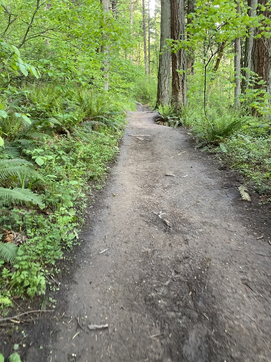
I had ridden this section of the route a couple times in the months leading up to the race since I was unfamiliar with it and figured I'd be doing it in the dark. The first ride was with an older version of the route that used some abandoned roads to navigate towards the paved road close to Alsea falls. The new section of the route instead descended on a mix of old pavement and gravel roads with chunky gravel meant for logging trucks, to bring riders towards Alpine. I liked the new route better, but that gravel was rough.
More gravel brought us towards Bellfountain. It was around 3-4AM and this is where I felt the most tired, being awake for so long and being out of the woods. I had became desensitized to the discomfort of the rain, and the sound of it was more soothing and made me sleepy.
A New Day
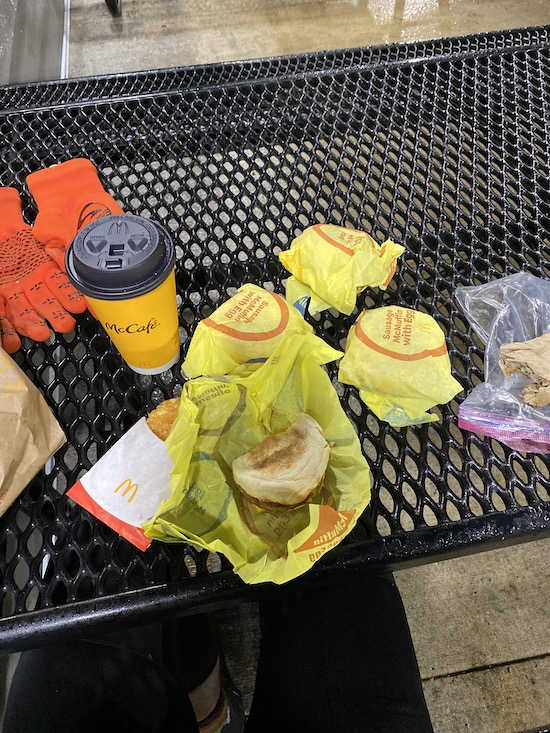
While continuing to rain, I could see the sun try to shine light through the grey clouds, and this helped me wake up. I rolled into Philomath right when the McDonalds drive-thru opened. I had been eating food through the night but was feeling very hungry, and the thought of hot food sounded really nice.
I brought 4 sausage egg McMuffins, two hash browns, and a large hot chocolate to one of their outdoor picnic tables, barely sheltered from the rain, since their dining room wasn't open yet. I ate everything.
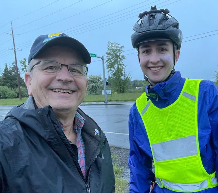
I continued towards Corvallis, the city I grew up in, and saw my Dad shaking a cowbell at an intersection at 6AM in the rain. What a great way to wake back up! My Dad is a great advocate for my self-supported biking endeavors and makes sure to not offer anything. He acknowledges that if he did provide anything, he'd need to provide it to all the other racers.
I resupplied at a gas station a little off route in Corvallis since nothing else was open. The rain was starting to lighten up, so I took off my rain jacket. I had been soaked for over 12 hours at this point, but I was optimistic the warmer temperatures today would allow me to keep my jacket off for the rest of the ride.
I had ridden the route north of Corvallis plenty of times, but mainly because it went on trails and gravel roads that I've ridden countless times over the years. This section went through Oregon State University's McDonald research forest, which is open to the public and provides some great views of the area.
The McDonald forest exited onto quiet paved roads heading north towards Monmouth. A section of gravel on Fishback road felt exceptionally steep. I remember feeling like I had been climbing forever on the steepest road, only to realize I've only gone up a couple hundred feet. My legs were definitely feeling tired, but luckily, the McDonald forest was the last large climb on the route, with mainly shorter punchy climbs for the remainder of the route.
There was a brief section of busy highway connecting Independence to the outskirts of Salem. Rain started back up around here too. To top it off, I got a puncture in my rear tire, but luckily it sealed up almost instantly and I only had to add a little air back in.
With traffic picking up and a small shoulder, I was really looking forward to getting off the highway. As if Nathan was watching and said "Oh you want off the highway? Well here you go!", the route took a turn to up an incredibly steep and loose gravel road. No cars, though! I just walked this section, since I don't think riding would've been any faster. Pavement resumed but steep rolling hills continued to Salem and then the route joined a flat bike path.
The sun finally came back out and the route joined flat, quiet farm roads towards Saint Paul. I still had a tailwind, and with the sun out, I think this was the easiest riding since the start of the ride yesterday on the Springwater Corridor.
Despite the nice conditions, I think it goes without saying that being over 325 miles into a ride with no sleep, I was really scraping at the bottom of the barrel to finish this thing. My legs felt very heavy, and a huge perceived exertion resulted in a very average amount of speed. The smallest hills felt even bigger, and my ass was tired of sitting.
I'm so thankful for the nice weather, tailwinds, and less aggressive hills that continued towards the end of the ride.
Rolling into Canby, the route originally would take a ferry to cross the Willamette River, but since the ferry was out of service, the route took us over a medium-sized hill into Oregon City. After Oregon City, the I-205 path took me back towards the Springwater Corridor to finish on Powell Butte, the official end of the race.
Despite approaching the finish, I was lodging about 6 miles away from Powell Butte and was dreading the extra miles to officially be done biking. The ride ended with a muddy mix of hike-a-bike and singletrack trail to the top of Powell Butte. That hiking at the end was a struggle. My feet were incredibly sore, and the fact that they've been soaked for 24 hours didn't help.
There was an interesting monument at the top pointing to all the nearby mountains, so I figured that was the finish line. I posted a video to the tracker app. I remember a friendly guy with his grandchildren sparked a conversation with me, but started to ramble about spotting elk in the local area. My brain was pretty scrambled at this point, but luckily, a phone call from my uncle who lives in Portland interrupted the conversation.
My uncle was at Powell Butte and was looking for me! He even had a bike rack and offered to take me back to where I'd sleep for the rest of the weekend. I'm so grateful for this surprise, since after I officially finished the race, my brain turned off whatever was mentally blocking me from the brunt of the pain and soreness that had been building up for the past 36 hours.
We went down to the parking lot, I took off all my bags, and he even let me take off my shoes in socks in the car (with the condition that we roll down all the windows).
The rest of the evening included eating $40 worth of whatever Uber Eats could bring me, showering, and falling asleep faster than I ever had before.
A week later, I'm still dealing with some knee soreness, hand numbness, and hematoma in my left big toe that I attribute to new shoes that were too small. In the end, I'm proud of my effort on this race, but I'm not proud of the physical effects I'm still feeling. I think this is the extent of damage I'm willing to endure after a ride like this. I value being able to ride and be physically active every day, so when something gets in the way of that (even if self-inflicted), it really discourages me. I think I found my limit for a single-ride effort, and I'm content with that.
Gear
My goal for gear and bike setup was to keep things light, but to be prepared.
Bike
Frame: Otso Waheela C, size XL. Covered in reflective tape with a sticker containing me and my partner's name and contact info (per race requirements).
Wheels: Front, HED Belgium G 32 spoke with SONdelux dynamo hub. Rear, HED Belgium Plus Disc 32 spoke with DT Swiss 350 hub.
Tires: Rene Herse Snoqualmie Pass 700x44, Endurance casing.
Drivetrain: Shimano GRX, 31/48 crankset, 11-34 cassette.
Fenders: SKS B53 Commuter II. My thoughts on fenders are that they only delay the amount of time it takes to get soaked on a rainy ride, but they do a great job at keeping your bike and body clean from dirt and grit.
Bags
Frame bag: Ortlieb Top Tube Frame Bag
Saddle bag: Ortlieb Seat Pack
Top tube bag: Revelate Designs Gas Tank
Also for this race, I organized the contents of my frame bag into six wallet-sized zipper canvas pouches I purchased on Amazon. These did a really good job at organizing like-things together (bike repair, wires, etc).
Bike Repair
- Two spare tubes
- Tubeless plug tool with lots of bacon strips
- Vulcanizing patch kit with glue
- Emergency tire boots
- Valve core tool
- Tire lever
- Spare spoke nipples
- Spare tire sealant
- An assortment of spare fender bolts and washers
- A few master links
- Gorilla tape
- Multi-tool with spoke wrench and chain breaker
- Hand pump with digital PSI gauge
- Zip ties
- Presta to Schrader adapter
- Chain lube
- Chain rag
Electronics
- Wahoo Elemnt Bolt for primary navigation
- iPhone for dot tracking and backup navigation
- Spot Gen4 Satellite Tracker for emergency tracking and communication. This race was exclusively tracked on the phone app, but I carry my own Spot tracker for backup emergency communication.
- Anker 20,000 mAh USB powerbank
- Anker 13,000 mAh USB powerbank
- SON Edelux II Dynamo light
- Niterider Lumina 1100 as a helmet light and backup headlight
- Garmin Varia radar taillight
- Cygolite Hotshot taillight as a backup
- Too many different types of USB cables to charge all these batteries.
- Heart rate monitor
Clothing
- Long sleeve synthetic base layer
- Short sleeve jersey
- Knee/leg warmers
- Pactimo 12 hour bib
- Twin Six lightweight jacket
- Patagonia synthetic down packable jacket. Never used this. Mainly brought it as emergency warmth in case I was stuck fixing my bike and getting cold.
- Mountain Hardwear rain jacket.
- Pearl Izumi Cyclone Gel gloves
- Giro fingerless gloves
- Showers Pass rain gloves
- Medium weight wool socks that I wore most of the time
- Spare lightweight socks
- Spare thick wool socks
- Neck buff
- High-viz reflective vest for night riding (per race requirements)
Other
- Chap stick
- Sunscreen
- Wallet
- Photochromic sunglasses with mirror attached
- Road ID on my wrist with me and my partner's name and contact info (per race requirements)
- Chamois cream
- BZK antiseptic wipes
- Toothbrush
- Toothpaste
- Chemical hand warmers
- Three 26 oz. water bottles, but I only used two and reserved the third for either extra water capacity or extra storage if needed. Ended up not using it for either purpose.